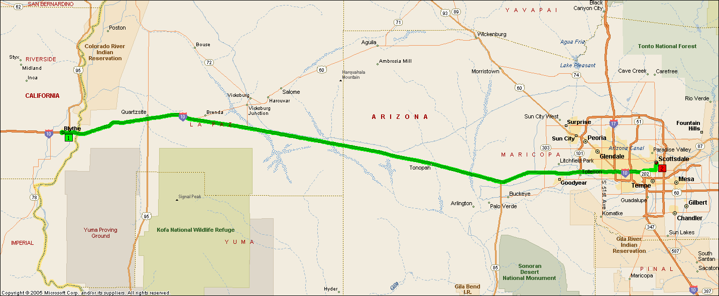
| Time |
Distance |
Instruction |
| | Check your departure time; the next stop is in a different time zone. |
| 11:00 AM | 0.0 | 1 Depart Blythe on I-10 Bus (West) for 0.4 mi |
| 11:00 AM | 0.4 | Turn LEFT (South) onto S Lovekin Blvd for 0.2 mi |
| 11:01 AM | 0.6 | Turn LEFT (East) onto W Donlon St for 65 yds towards I-10 |
| 11:02 AM | 0.7 | Take Ramp (LEFT) onto I-10 for 150.9 mi |
| 11:06 AM | 4.9 | Entering Arizona |
| 1:11 PM | 151.6 | Keep LEFT onto SR-202 Loop HOV Ln for 0.7 mi towards AZ-202-LOOP HOV |
| 1:12 PM | 152.3 | Road name changes to SR-202 Loop for 2.4 mi |
| 1:14 PM | 154.8 | At exit 3, turn RIGHT onto Ramp for 0.3 mi towards AZ-143 / Washington St / McDowell Rd |
| 1:14 PM | 155.1 | Take Ramp (LEFT) onto SR-143 [Hohokam Expy] for 0.7 mi towards McDowell Rd |
| 1:16 PM | 155.8 | Take Local road(s) onto E McDowell Rd for 3.2 mi towards McDowell Rd East |
| 1:20 PM | 159.0 | Turn LEFT (North) onto N Scottsdale Rd for 1.3 mi |
| 1:22 PM | 160.3 | Keep RIGHT onto N Drinkwater Blvd for 0.8 mi towards Express |
| | Check local time; this stop is in a different time zone. |
| 1:23 PM | 161.1 | Turn RIGHT (East) onto E 1st Ave for 32 yds |
| 1:24 PM | 161.1 | 2 Arrive Scottsdale |
Copyright © 1988-2005 Microsoft Corp. and/or its suppliers. All rights reserved.
http://www.microsoft.com/streets/ © 2004 NAVTEQ. All rights reserved. This data includes information taken with permission from Canadian authorities © Her Majesty the Queen in Right of Canada. © Copyright 2004 by TeleAtlas North America, Inc. All rights reserved.